
1955 Map of Baird Mountains C-3
USGS Topo · Published 1970About this map
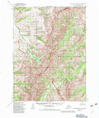
Sapum Creek and its numerous unnamed tributaries carve through this high Arctic landscape in the mid-1950s, representing a region defined by its complex drainage systems and lack of permanent settlements. Mapped by the Army Map Service and later published by the Geological Survey, the area shows a pattern of high-elevation terrain where seasonal waterways like Nakolikurok Creek and Anaktok Creek descend from unnamed peaks. The 1955 photogrammetric methods used here reveal a transition from the southern waters of Takpahlearik Creek to the northern drainages of Sapum Creek. This sheet documents a moment in time when the Bureau of Land Management had predetermined land lines for unsurveyed and unmarked locations, indicating a wilderness on the cusp of formal administrative definition but still devoid of any established infrastructure or named human landmarks.
Find a feature on this map
4 named features on this map. Tap any name to fly to it.
Don’t see what you’re looking for? This feature index may not catch every label — zoom into the map to look around manually.
Map Details
Editions of this 1955 Baird Mountains C-3 Map
2 editions found
Other maps of this area

1951 · Baird Mountains
USGS Topo · 1:250,000

1955 · Baird Mountains D-4
USGS Topo · 1:63,360

1955 · Baird Mountains D-3
USGS Topo · 1:63,360

1955 · Baird Mountains C-4
USGS Topo · 1:63,360

1955 · Baird Mountains B-3
USGS Topo · 1:63,360
1955 · Baird Mountains B-4
USGS Topo · 1:63,360

1956 · Baird Mountains
USGS Topo · 1:250,000

1965 · Baird Mountains
USGS Topo · 1:250,000
1990 · Baird Mountains B-2
USGS Topo · 1:63,360
1990 · Baird Mountains D-2
USGS Topo · 1:63,360