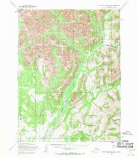
1955 Map of Baird Mountains B-4
USGS Topo · Published 1970About this map
The Omar River serves as the central drainage of this Northwest Arctic landscape, captured during a mid-century aerial survey by the Army Map Service. Flowing through the heart of the Baird Mountains, the river is fed by several prominent tributaries, including Tukpahlearik Creek and Timber Creek in the east. This 1950s documentation shows the region's wilderness character before significant modern impacts, focusing on the intricate drainage patterns and elevation contours that define the drainage basin. Farther south, the confluence with Spruce Creek marks a transition in the local topography. This map represents an era of primary geological and geographical data gathering in the Alaskan interior, where surveyors relied on photogrammetric methods to chart the unsurveyed land lines of the Bureau of Land Management.
Find a feature on this map
4 named features on this map. Tap any name to fly to it.
Don’t see what you’re looking for? This feature index may not catch every label — zoom into the map to look around manually.
Map Details
Editions of this 1955 Baird Mountains B-4 Map
This is the sole edition of this map. No revisions or reprints were ever made.
Other maps of this area

1951 · Baird Mountains
USGS Topo · 1:250,000
1955 · Baird Mountains A-5
USGS Topo · 1:63,360

1955 · Baird Mountains C-4
USGS Topo · 1:63,360
1955 · Baird Mountains C-5
USGS Topo · 1:63,360

1955 · Baird Mountains B-3
USGS Topo · 1:63,360

1955 · Baird Mountains A-3
USGS Topo · 1:63,360
1955 · Baird Mountains B-5
USGS Topo · 1:63,360

1955 · Baird Mountains C-3
USGS Topo · 1:63,360

1955 · Baird Mountains A-4
USGS Topo · 1:63,360

1956 · Baird Mountains
USGS Topo · 1:250,000