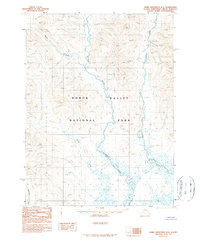
1990 Map of Baird Mountains B-2
USGS Topo · Published 1990About this map
Kobuk Valley National Park encompasses the majority of this Alaskan wilderness as it appeared during the late 20th century. This area is defined by a significant drainage network of Arctic rivers, dominated by the winding course of the Salmon River and the Tutuksuk River. Unlike more settled regions, the landscape here is characterized by its hydrological features and high-altitude surveying points such as Kall, showing the interior before any road infrastructure reached these remote latitudes. The lack of settlements or roads underscores the region's preservation under the Alaska National Interest Lands Conservation Act, focusing instead on the natural topography of the Baird Mountains range. Smaller waterways like the Nikak River, Kitlik River, and Kallarichuk River feed into the larger river systems, illustrating the complex watershed of the Northwest Arctic Borough.
Find a feature on this map
11 named features on this map. Tap any name to fly to it.
Don’t see what you’re looking for? This feature index may not catch every label — zoom into the map to look around manually.
Map Details
Editions of this 1990 Baird Mountains B-2 Map
This is the sole edition of this map. No revisions or reprints were ever made.
Other maps of this area

1951 · Baird Mountains
USGS Topo · 1:250,000

1955 · Baird Mountains A-1
USGS Topo · 1:63,360

1955 · Baird Mountains A-2
USGS Topo · 1:63,360

1955 · Baird Mountains B-3
USGS Topo · 1:63,360

1955 · Baird Mountains A-3
USGS Topo · 1:63,360

1955 · Baird Mountains C-3
USGS Topo · 1:63,360

1956 · Baird Mountains
USGS Topo · 1:250,000

1965 · Baird Mountains
USGS Topo · 1:250,000
1990 · Baird Mountains C-1
USGS Topo · 1:63,360
1990 · Baird Mountains B-1
USGS Topo · 1:63,360