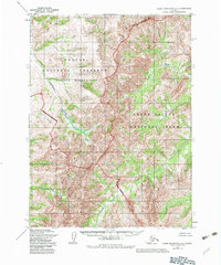
1955 Map of Baird Mountains C-3
USGS Topo · Published 1983About this map
Noatak National Preserve and Kobuk Valley National Park meet in this remote Arctic landscape, where the boundary between these federally protected lands is defined by the high ridges of the Baird Mountains. Based on 1955 photography and updated in the early 1980s, the map documents a transition zone between the Noatak Wilderness and the forested drainages to the south. Several significant waterways drain the mountain slopes, including Anaktok Creek and Nakolikurok Creek, illustrating the natural drainage patterns of the region before the formalization of the Alaska National Interest Lands Conservation Act. The lack of any roads or trails highlights the undisturbed nature of the territory, where the terrain is governed by the flow of seasonal waters like Saput Creek and Pukpahlearik Creek.
Find a feature on this map
10 named features on this map. Tap any name to fly to it.
Don’t see what you’re looking for? This feature index may not catch every label — zoom into the map to look around manually.
Map Details
Editions of this 1955 Baird Mountains C-3 Map
2 editions found
Other maps of this area

1951 · Baird Mountains
USGS Topo · 1:250,000

1955 · Baird Mountains D-4
USGS Topo · 1:63,360

1955 · Baird Mountains D-3
USGS Topo · 1:63,360

1955 · Baird Mountains C-4
USGS Topo · 1:63,360

1955 · Baird Mountains B-3
USGS Topo · 1:63,360
1955 · Baird Mountains B-4
USGS Topo · 1:63,360

1955 · Baird Mountains C-3
USGS Topo · 1:63,360

1956 · Baird Mountains
USGS Topo · 1:250,000

1965 · Baird Mountains
USGS Topo · 1:250,000
1990 · Baird Mountains B-2
USGS Topo · 1:63,360