
1955 Map of Selawik C-4
USGS Topo · Published 1969About this map
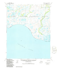
Selawik Lake dominates the southern landscape of this 1955 survey, where the massive water body meets a shoreline characterized by intricate wetlands and wandering waterways. The Singauruk River winds through the eastern portion of the quadrangle, punctuated by its passage past Singauruk Pt before emptying into the lake. This mapping effort, based on aerial photographs taken in the mid-1950s, reveals a remote subarctic environment defined by complex drainage patterns and seasonal tundra lakes. Smaller tributaries like Kokopuk Creek and Napatolik Creek carve through the north and east, illustrating the delicate hydrologic network of the Northwest Arctic. The map documents unsurveyed land lines predetermined by the Bureau of Land Management, reflecting an era of early territorial administration and resource inventory in Alaska.
Find a feature on this map
5 named features on this map. Tap any name to fly to it.
Don’t see what you’re looking for? This feature index may not catch every label — zoom into the map to look around manually.
Map Details
Editions of this 1955 Selawik C-4 Map
2 editions found
Other maps of this area

1951 · Selawik
USGS Topo · 1:250,000

1951 · Selawik B-5
USGS Topo · 1:63,360

1955 · Selawik B-3
USGS Topo · 1:63,360

1955 · Selawik D-4
USGS Topo · 1:63,360

1955 · Selawik D-5
USGS Topo · 1:63,360

1955 · Selawik C-3
USGS Topo · 1:63,360

1955 · Selawik B-4
USGS Topo · 1:63,360

1955 · Selawik C-5
USGS Topo · 1:63,360

1955 · Selawik D-3
USGS Topo · 1:63,360

1957 · Selawik
USGS Topo · 1:250,000