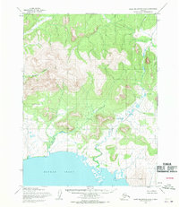
1955 Map of Baird Mountains A-6
USGS Topo · Published 1970About this map
Hotham Inlet dominates the southern portion of this mid-century survey, where the waters of the Northwest Arctic meet the coastal tundra. The landscape transitions from the tidal reaches of the inlet into a series of steep, unnamed ridges and peaks characteristic of the Baird Mountains range. Drainage for the western slopes is provided by Shiliak Creek, which carves a narrow valley through the high ground before descending toward the coast. Mapped by the Army Map Service using aerial photography from the mid-1950s, this sheet documents a wilderness area defined by its lack of established roads or permanent settlements. The topographic detail reveals the intricate hydrology of the region, where numerous small, unnamed streams and ponds dot the lowland flats between the mountains and the sea.
Find a feature on this map
2 named features on this map. Tap any name to fly to it.
Don’t see what you’re looking for? This feature index may not catch every label — zoom into the map to look around manually.
Map Details
Editions of this 1955 Baird Mountains A-6 Map
This is the sole edition of this map. No revisions or reprints were ever made.
Other maps of this area

1951 · Baird Mountains
USGS Topo · 1:250,000

1951 · Selawik
USGS Topo · 1:250,000

1951 · Noatak
USGS Topo · 1:250,000

1951 · Kotzebue
USGS Topo · 1:250,000

1951 · Kotzebue D-1
USGS Topo · 1:63,360

1951 · Selawik D-6
USGS Topo · 1:63,360

1952 · Selawik D-6
USGS Topo · 1:63,360

1955 · Noatak
USGS Topo · 1:250,000

1955 · Selawik D-5
USGS Topo · 1:63,360
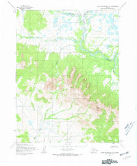
1955 · Baird Mountains A-5
USGS Topo · 1:63,360