
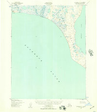
1952 Map of Selawik D-6
USGS Topo · Published 1954About this map
Turnagain Arm dominates this 1952 topographic study, revealing the transportation corridor between Anchorage and Seward during a period of significant postwar development. The map details the parallel routes of The Alaska Railroad and the Seward Anchorage Highway as they skirt the tidal mudflats and mountain slopes of the Chugach National Forest. Settlements like Girdwood, Kern, and Portage appear as small hubs along these vital arteries, while the presence of the Twentymile Sawmill (Abandoned) and the Lower Engineers Camp points to the area's industrial and infrastructure history. Numerous glacial meltwater streams, including the Placer River and Twentymile River, carve through the landscape, feeding into the silt-laden waters of the arm. Local landmarks like the Emergency Landing Field near Portage and the Air Strip at Girdwood reflect the era's reliance on aviation for regional connectivity.
Find a feature on this map
36 named features on this map. Tap any name to fly to it.
Don’t see what you’re looking for? This feature index may not catch every label — zoom into the map to look around manually.
Map Details
Editions of this 1952 Selawik D-6 Map
This is the sole edition of this map. No revisions or reprints were ever made.
Other maps of this area

1951 · Baird Mountains
USGS Topo · 1:250,000

1951 · Selawik
USGS Topo · 1:250,000

1951 · Noatak
USGS Topo · 1:250,000

1951 · Kotzebue
USGS Topo · 1:250,000

1951 · Kotzebue D-1
USGS Topo · 1:63,360

1951 · Selawik C-6
USGS Topo · 1:63,360

1951 · Selawik D-6
USGS Topo · 1:63,360
1951 · Kotzebue C-1
USGS Topo · 1:63,360

1955 · Noatak
USGS Topo · 1:250,000

1955 · Selawik D-5
USGS Topo · 1:63,360