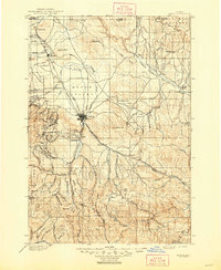
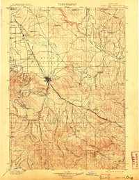
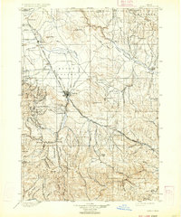
1901 Map of Baker
USGS Topo · Published 1948About this map
The Baker hub and its surrounding gold-mining and agricultural valleys appear here at the close of the 19th century. Surveyed by R.H. Mc Kee and S.S. Gannett, the map captures the transition from pioneer trail routes to established rail networks. The historic Oregon Trail winds through the eastern hills, passing near Virtue Flat, while the Union Pacific and Oregon-Washington Railroad & Navigation Co. define the modern transport corridors.
Find a feature on this map
102 named features on this map. Tap any name to fly to it.
Don’t see what you’re looking for? This feature index may not catch every label — zoom into the map to look around manually.
Map Details
Editions of this 1901 Baker Map
4 editions found
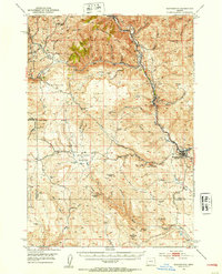
Other maps of this area

1901 · Baker City
USGS Topo · 1:125,000

1901 · Sumpter
USGS Topo · 1:125,000

1906 · Telocaset
USGS Topo · 1:125,000

1908 · Ironside Mountain
USGS Topo · 1:125,000

1915 · Pine
USGS Topo · 1:125,000
1951 · Huntington
USGS Topo · 1:62,500

1953 · Pendleton
USGS Topo · 1:250,000

1954 · Eagle Cap
USGS Topo · 1:62,500

1955 · Baker
USGS Topo · 1:250,000

1955 · Grangeville
USGS Topo · 1:250,000