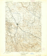
1901 Map of Baker
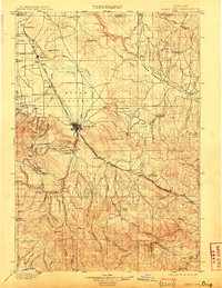
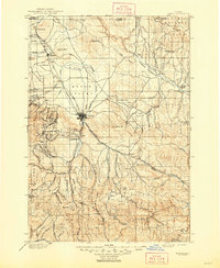
USGS Topo · Published 1934About this map
Baker serves as the central hub of this Eastern Oregon landscape, where the Oregon Railroad and Navigation Company tracks intersect with the narrow-gauge Sumpter Valley Railroad. This turn-of-the-century environment is defined by its transit corridors and extractive industry, with the iconic Oregon Trail winding through the southeastern terrain near Pleasant Valley. To the east, the Virtue Flat district reveals the region's mining heritage through the Flagstaff Mine and Virtue Mine.
Find a feature on this map
90 named features on this map. Tap any name to fly to it.
Don’t see what you’re looking for? This feature index may not catch every label — zoom into the map to look around manually.
Map Details
Editions of this 1901 Baker Map
4 editions found
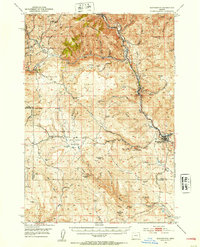
Other maps of this area

1901 · Baker City
USGS Topo · 1:125,000

1901 · Sumpter
USGS Topo · 1:125,000

1906 · Telocaset
USGS Topo · 1:125,000

1908 · Ironside Mountain
USGS Topo · 1:125,000

1915 · Pine
USGS Topo · 1:125,000
1951 · Huntington
USGS Topo · 1:62,500

1953 · Pendleton
USGS Topo · 1:250,000

1954 · Eagle Cap
USGS Topo · 1:62,500

1955 · Baker
USGS Topo · 1:250,000

1955 · Grangeville
USGS Topo · 1:250,000