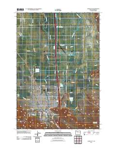
2011 Map of Baker City
USGS Topo · Published 2011About this map
Baker City serves as the focal point of this 2011 survey, situated within the fertile Baker Valley and surrounded by an intricate network of irrigation and water management features. The Powder River meanders through the landscape, flanked by numerous historical ditches such as Estes Ditch, Corral Ditch, and Smith Ditch, which underscore the region's agricultural dependency. The town's layout is clearly defined, showing the Baker City Post Office and the expansive Mount Hope Cemetery on its southern edge.
Find a feature on this map
52 named features on this map. Tap any name to fly to it.
Don’t see what you’re looking for? This feature index may not catch every label — zoom into the map to look around manually.
Map Details
Editions of this 2011 Baker City Map
This is the sole edition of this map. No revisions or reprints were ever made.
Other maps of this area
1901 · Baker City
USGS Topo · 1:125,000

1955 · Baker
USGS Topo · 1:250,000

1959 · Baker
USGS Topo · 1:250,000

1967 · Virtue Flat
USGS Topo · 1:24,000
1967 · Encina
USGS Topo · 1:24,000
1967 · Baker
USGS Topo · 1:24,000
1967 · Keating NW
USGS Topo · 1:24,000
1967 · Haines
USGS Topo · 1:24,000
1967 · Magpie Peak
USGS Topo · 1:24,000
1967 · Blue Canyon
USGS Topo · 1:24,000