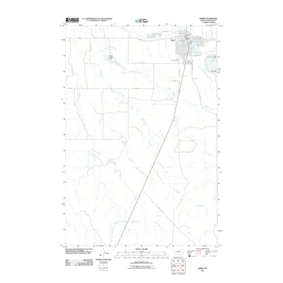
2011 Map of Baker
USGS Topo · Published 2011About this map
Baker serves as the focal point of this Eastern Montana landscape, established at the intersection of early transportation routes and the managed waters of Lake Baker. The town's civic structure is well-defined by the Fallon County Fairgrounds, Baker Municipal Airport, and the Baker Post Office, while the grid of streets includes names like Milwaukee Ave, nodding to the region's railroad heritage. The surrounding prairie is drained by a network of seasonal waterways including Sandstone Creek, Red Butte Creek, and Timber Creek. Human engineering of this semi-arid environment is evident in the series of water control structures, specifically Red Butte Dam, Lower Baker Dam, and Upper Baker Dam, which were essential for sustaining the local community and ranching operations. To the southwest of the main town site, Saint John Cemetery provides a localized point of interest for researchers tracing the early families and settlers of Fallon County.
Find a feature on this map
24 named features on this map. Tap any name to fly to it.
Don’t see what you’re looking for? This feature index may not catch every label — zoom into the map to look around manually.
Map Details
Editions of this 2011 Baker Map
This is the sole edition of this map. No revisions or reprints were ever made.
Other maps of this area

1953 · Miles City
USGS Topo · 1:250,000

1957 · Miles City
USGS Topo · 1:250,000

1958 · Miles City
USGS Topo · 1:250,000

1981 · Webster NW
USGS Topo · 1:24,000

1981 · Baker
USGS Topo · 1:100,000

1981 · Baker NE
USGS Topo · 1:24,000

1981 · Buffalo Reservoir
USGS Topo · 1:24,000

1981 · Baker
USGS Topo · 1:24,000

1981 · South Sandstone Reservoir
USGS Topo · 1:24,000

1981 · Willard
USGS Topo · 1:24,000