
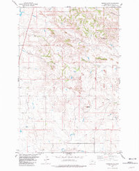
1981 Map of Baker NE
USGS Topo · Published 1981About this map
Monarch Oil Field and the Pennel Oil Field dominate the landscape of Fallon County, Montana, as they appeared in the early 1980s. This industrial footprint is characterized by a network of pipelines, gas wells, and oil wells that crisscross the prairie terrain around Antelope Butte. The southern portion of the map is defined by the heavy infrastructure of the Chicago Milwaukee St Paul and Pacific railroad, which runs parallel to Sandstone Creek. A single community landmark, the Bonnievale Cem, sits near a Substa in the southeast, providing a focal point for local genealogical interest. The natural drainage of the region is traced through the winding paths of Pennel Creek and Cottonwood Creek, which cut through the oil-producing lands of the northern Great Plains.
Find a feature on this map
11 named features on this map. Tap any name to fly to it.
Don’t see what you’re looking for? This feature index may not catch every label — zoom into the map to look around manually.
Map Details
Editions of this 1981 Baker NE Map
This is the sole edition of this map. No revisions or reprints were ever made.
Other maps of this area

1953 · Miles City
USGS Topo · 1:250,000

1957 · Miles City
USGS Topo · 1:250,000

1958 · Miles City
USGS Topo · 1:250,000

1981 · Baker
USGS Topo · 1:100,000

1981 · Buffalo Reservoir
USGS Topo · 1:24,000

1981 · Baker
USGS Topo · 1:24,000

1981 · South Sandstone Reservoir
USGS Topo · 1:24,000

1981 · Lawrence Creek East
USGS Topo · 1:24,000

1981 · Baker NW
USGS Topo · 1:24,000
1981 · Morris Butte
USGS Topo · 1:24,000