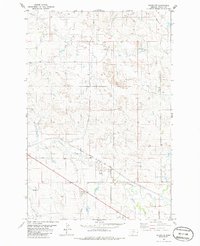
Monarch Oil Field anchors the northeastern corner of this Fallon County landscape, highlighting the industrial footprint of petroleum extraction in eastern Montana during the early 1980s. The terrain is defined by a network of drainage systems, including Pennel Creek in the north and the winding course of Sandstone Creek further south, which is joined by the South Fork Sandstone Creek and Timber Creek. This period captures the infrastructure of the Chicago Milwaukee St Paul and Pacific railroad as it cuts diagonally across the prairie, supported by local landmarks like a Pumping Sta and a network of pipelines. The map provides a clear view of the ranching and resource-extraction patterns of the era, where section lines and fences intersect with natural watercourses and energy corridors.
13 named features on this map. Tap any name to fly to it.
Don’t see what you’re looking for? This feature index may not catch every label — zoom into the map to look around manually.
2 editions found
64 maps found

1980 Snider Hill
Fallon County, MT

1981 Ayer Spring
Fallon County, MT

1981 Ayer Spring NE
Fallon County, MT

1981 Badland Draw
Fallon County, MT

1981 Baker NE
Fallon County, MT

1981 Baker NW
Fallon County, MT

1981 Bracket Butte SE
Fallon County, MT

1981 Buffalo Reservoir
Fallon County, MT

1981 Harmon Butte
Fallon County, MT

1981 Ismay South
Fallon County, MT

1981 Lawrence Creek East
Fallon County, MT

1981 Lawrence Creek West
Fallon County, MT

1981 Little Pine Creek
Fallon County, MT

1981 Medicine Rocks State Park
Fallon County, MT

1981 Morris Butte
Fallon County, MT

1981 Nelson Butte
Fallon County, MT

1981 Ollie
Fallon County, MT

1981 Rush Hall Reservoir
Fallon County, MT

1981 Scole School
Fallon County, MT

1981 Seven-Up Butte
Fallon County, MT

1981 Shell Butte
Fallon County, MT

1981 South Sandstone Reservoir
Fallon County, MT

1981 Sportsman Pond
Fallon County, MT

1981 T G Creek
Fallon County, MT

1981 Waterhole Creek
Fallon County, MT

1981 Webster
Fallon County, MT

1981 Webster NW
Fallon County, MT

1981 Westmore
Fallon County, MT

1981 Willard
Fallon County, MT

1981 Willard SE
Fallon County, MT

1997 Badland Draw
Fallon County, MT

1997 Ollie
Fallon County, MT

1997 Waterhole Creek
Fallon County, MT

2024 Ayer Spring
Fallon County, MT

2024 Ayer Spring NE
Fallon County, MT

2024 Badland Draw
Fallon County, MT

2024 Baker NE
Fallon County, MT

2024 Baker NW
Fallon County, MT

2024 Bracket Butte SE
Fallon County, MT

2024 Buffalo Reservoir
Fallon County, MT

2024 Harmon Butte
Fallon County, MT

2024 Ismay South
Fallon County, MT

2024 Lawrence Creek East
Fallon County, MT

2024 Lawrence Creek West
Fallon County, MT

2024 Little Pine Creek
Fallon County, MT

2024 Medicine Rocks State Park
Fallon County, MT

2024 Morris Butte
Fallon County, MT

2024 Nelson Butte
Fallon County, MT

2024 Ollie
Fallon County, MT

2024 Rush Hall Reservoir
Fallon County, MT

2024 Scole School
Fallon County, MT

2024 Seven-up Butte
Fallon County, MT

2024 Shell Butte
Fallon County, MT

2024 Snider Hill
Fallon County, MT

2024 South Sandstone Reservoir
Fallon County, MT

2024 Sportsman Pond
Fallon County, MT

2024 T G Creek
Fallon County, MT

2024 Waterhole Creek
Fallon County, MT

2024 Webster
Fallon County, MT

2024 Webster NE
Fallon County, MT

2024 Webster NW
Fallon County, MT

2024 Westmore
Fallon County, MT

2024 Willard
Fallon County, MT

2024 Willard SE
Fallon County, MT