
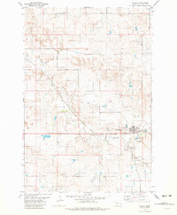
1981 Map of Lawrence Creek West
USGS Topo · Published 1981About this map
Lawrence Creek and Dry Fork Creek carve through this Montana landscape, illustrating a drainage system defined by seasonal water flow and scattered springs. The terrain in this part of Fallon County is marked by a network of ranching infrastructure, where numerous wells and extensive fence lines—indicated by fine red dashed lines—point to the area's primary agricultural use during the late 1970s and early 1980s.
Find a feature on this map
10 named features on this map. Tap any name to fly to it.
Don’t see what you’re looking for? This feature index may not catch every label — zoom into the map to look around manually.
Map Details
Editions of this 1981 Lawrence Creek West Map
This is the sole edition of this map. No revisions or reprints were ever made.
Other maps of this area

1953 · Miles City
USGS Topo · 1:250,000

1957 · Miles City
USGS Topo · 1:250,000

1958 · Miles City
USGS Topo · 1:250,000

1981 · Baker
USGS Topo · 1:100,000

1981 · Lawrence Creek East
USGS Topo · 1:24,000

1981 · Baker NW
USGS Topo · 1:24,000

1981 · Dorothy Draw
USGS Topo · 1:24,000

1981 · Ayer Spring NE
USGS Topo · 1:24,000

1981 · Ayer Spring
USGS Topo · 1:24,000
1981 · Plevna
USGS Topo · 1:24,000