
1981 Map of Ayer Spring
USGS Topo · Published 1981About this map
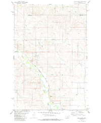
Ayer Spring and the headwaters of Pennel Creek characterize this high plains landscape at the intersection of Prairie, Custer, and Fallon counties. The terrain is marked by a complex drainage network where Dry Fork Pennel Creek joins the main branch, reflecting the seasonal hydrology of eastern Montana. While much of the land remains open range, the inclusion of several labeled Well sites and a Drill Hole indicates mid-century energy exploration efforts. A long Pipeline segment cuts across the central sections of the map, illustrating the infrastructure required to move resources across this sparsely settled territory. The map also delineates several township and range boundaries, providing a clear record of land division in a region dominated by Pine Creek and various unnamed ephemeral springs.
Find a feature on this map
11 named features on this map. Tap any name to fly to it.
Don’t see what you’re looking for? This feature index may not catch every label — zoom into the map to look around manually.
Map Details
Editions of this 1981 Ayer Spring Map
This is the sole edition of this map. No revisions or reprints were ever made.
Other maps of this area

1953 · Miles City
USGS Topo · 1:250,000

1957 · Miles City
USGS Topo · 1:250,000

1958 · Miles City
USGS Topo · 1:250,000

1981 · Baker
USGS Topo · 1:100,000

1981 · Mildred NE
USGS Topo · 1:24,000

1981 · Lawrence Creek West
USGS Topo · 1:24,000
1981 · Ismay North
USGS Topo · 1:24,000

1981 · Dorothy Draw
USGS Topo · 1:24,000

1981 · Ayer Spring NE
USGS Topo · 1:24,000
1981 · Plevna
USGS Topo · 1:24,000