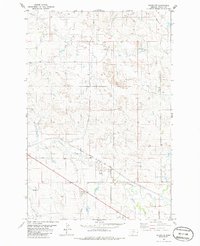
1981 Map of Baker NW
USGS Topo · Published 1986About this map
Monarch Oil Field defines the industrial character of this Fallon County landscape, with scattered Oil Wells and a Drill Hole indicating the extraction activity present during the mid-1970s and early 1980s. The region is bisected by the Chicago Milwaukee St Paul and Pacific railroad, which follows the natural corridor carved by Sandstone Creek. This transport and resource infrastructure is supported by a Pumping Sta and a network of pipelines that traverse the rolling terrain.
Find a feature on this map
15 named features on this map. Tap any name to fly to it.
Don’t see what you’re looking for? This feature index may not catch every label — zoom into the map to look around manually.
Map Details
Editions of this 1981 Baker NW Map
2 editions found

Other maps of this area

1953 · Miles City
USGS Topo · 1:250,000

1957 · Miles City
USGS Topo · 1:250,000

1958 · Miles City
USGS Topo · 1:250,000

1981 · Baker
USGS Topo · 1:100,000

1981 · Baker NE
USGS Topo · 1:24,000

1981 · Baker
USGS Topo · 1:24,000

1981 · South Sandstone Reservoir
USGS Topo · 1:24,000

1981 · Lawrence Creek East
USGS Topo · 1:24,000

1981 · Lawrence Creek West
USGS Topo · 1:24,000

1981 · Little Pine Creek
USGS Topo · 1:24,000