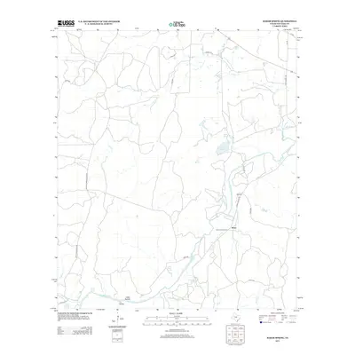
2013 Map of Baker Spring
USGS Topo · Published 2013About this map
The San Saba River defines the southern and eastern reaches of this landscape, carving a winding path through the Central Texas limestone. Near its banks, the settlement of Sloan and the Sloan Sisters Ranch represent the ranching heritage of San Saba County. The area is notably dense with natural springs, including the eponymous Baker Spring, Hart Springs, and the clustered Turkey Roost Springs and Flemming Spring near the river’s edge.
Find a feature on this map
33 named features on this map. Tap any name to fly to it.
Don’t see what you’re looking for? This feature index may not catch every label — zoom into the map to look around manually.
Map Details
Editions of this 2013 Baker Spring Map
This is the sole edition of this map. No revisions or reprints were ever made.
Other maps of this area

1885 · San Saba
USGS Topo · 1:125,000

1894 · Brady
USGS Topo · 1:125,000

1894 · San Saba
USGS Topo · 1:125,000

1928 · Mercury
USGS Topo · 1:62,500

1930 · Richland Springs
USGS Topo · 1:62,500

1948 · Richland Springs
USGS Topo · 1:62,500

1950 · Mercury
USGS Topo · 1:62,500
1950 · Richland Springs
USGS Topo · 1:62,500

1954 · Brownwood
USGS Topo · 1:250,000
1955 · Buffalo Knob
USGS Topo · 1:24,000