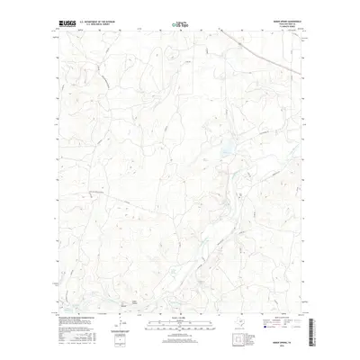
2016 Map of Baker Spring
USGS Topo · Published 2016About this map
San Saba River meanders through this portion of San Saba County, defining a landscape shaped by intermittent drainage and perennial springs. The area is characterized by a series of significant water sources, including Baker Spring, Hart Springs, and Turkey Roost Springs, which have historically anchored local ranching and settlement patterns. A network of rural roads, such as Richland Springs River Rd and S Cotton Belt Rd, connects isolated homesteads and ranch lands across the winding terrain of Cedar Hollow and T F Hollow.
Find a feature on this map
36 named features on this map. Tap any name to fly to it.
Don’t see what you’re looking for? This feature index may not catch every label — zoom into the map to look around manually.
Map Details
Editions of this 2016 Baker Spring Map
This is the sole edition of this map. No revisions or reprints were ever made.
Other maps of this area

1885 · San Saba
USGS Topo · 1:125,000

1894 · Brady
USGS Topo · 1:125,000

1894 · San Saba
USGS Topo · 1:125,000

1928 · Mercury
USGS Topo · 1:62,500

1930 · Richland Springs
USGS Topo · 1:62,500

1948 · Richland Springs
USGS Topo · 1:62,500

1950 · Mercury
USGS Topo · 1:62,500
1950 · Richland Springs
USGS Topo · 1:62,500

1954 · Brownwood
USGS Topo · 1:250,000
1955 · Buffalo Knob
USGS Topo · 1:24,000