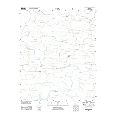
2011 Map of Baker Springs
USGS Topo · Published 2011About this map
The Cossatot River winds through this section of Arkansas, defining a landscape of numerous historical river crossings and small timber-road networks. This 2011 survey documents a remote area where the river's path is marked by a series of named fords, including Duckett Ford, Church Ford, and Baker Ford, indicating a long-standing reliance on these natural transit points before modern infrastructure. The map centers on the small settlements of Baker Springs, Hartley, and Duckett, providing a detailed look at the rural geography and family landmarks such as Duckett Cemetery and Center Cemetery.
Find a feature on this map
80 named features on this map. Tap any name to fly to it.
Don’t see what you’re looking for? This feature index may not catch every label — zoom into the map to look around manually.
Map Details
Editions of this 2011 Baker Springs Map
This is the sole edition of this map. No revisions or reprints were ever made.
Other maps of this area

1913 · De Queen
USGS Topo · 1:125,000

1950 · Mcalester
USGS Topo · 1:250,000

1959 · Umpire
USGS Topo · 1:62,500

1959 · Cove
USGS Topo · 1:62,500

1962 · McAlester
USGS Topo · 1:250,000

1964 · Gillham Dam
USGS Topo · 1:24,000

1964 · Gillham
USGS Topo · 1:24,000

1965 · McAlester
USGS Topo · 1:250,000
1966 · Dierks Dam
USGS Topo · 1:24,000
1984 · Vandervoort
USGS Topo · 1:24,000