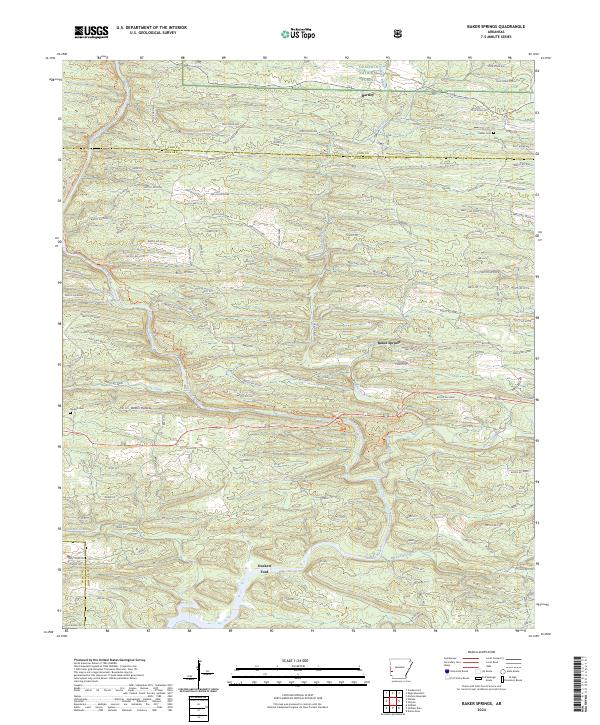
2024 Map of Baker Springs
USGS Topo · Published 2024About this map
The Cossatot Wild and Scenic River carves through the forested terrain of Howard and Polk counties, defining the character of this landscape in the western reaches of the Ouachita National Forest. Small settlements and family landmarks such as Baker Springs and Hartley dot the map, connected by a network of forest roads and more established routes like Highway 278. The terrain is marked by distinctive drainages including Baker Creek and Cow Creek, with deep local features like Devils Hollow and Duckett Ford providing evidence of long-established backcountry navigation.
Find a feature on this map
134 named features on this map. Tap any name to fly to it.
Don’t see what you’re looking for? This feature index may not catch every label — zoom into the map to look around manually.
Map Details
Editions of this 2024 Baker Springs Map
This is the sole edition of this map. No revisions or reprints were ever made.
Other maps of this area

1913 · De Queen
USGS Topo · 1:125,000

1950 · Mcalester
USGS Topo · 1:250,000

1959 · Umpire
USGS Topo · 1:62,500

1959 · Cove
USGS Topo · 1:62,500

1962 · McAlester
USGS Topo · 1:250,000

1964 · Gillham Dam
USGS Topo · 1:24,000

1964 · Gillham
USGS Topo · 1:24,000

1965 · McAlester
USGS Topo · 1:250,000
1966 · Dierks Dam
USGS Topo · 1:24,000
1984 · Vandervoort
USGS Topo · 1:24,000