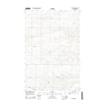
2014 Map of Bakers Spring
USGS Topo · Published 2014About this map
Bakers Spring and Sulphur Spring punctuate this high-country landscape in Fergus County, providing vital water sources in a region defined by complex drainage networks. The geography is carved by several significant coulees, including Sawmill Coulee, Deadman Coulee, and Burnt Timber Coulee, which channel runoff toward more permanent watercourses like Armells Cr and Sourdough Cr.
Find a feature on this map
18 named features on this map. Tap any name to fly to it.
Don’t see what you’re looking for? This feature index may not catch every label — zoom into the map to look around manually.
Map Details
Editions of this 2014 Bakers Spring Map
This is the sole edition of this map. No revisions or reprints were ever made.
Other maps of this area

1943 · Landusky
USGS Topo · 1:125,000

1954 · Baker Monument
USGS Topo · 1:24,000

1954 · Lewistown
USGS Topo · 1:250,000

1959 · Lewistown
USGS Topo · 1:250,000

1978 · Lewistown
USGS Topo · 1:100,000

1984 · Zortman
USGS Topo · 1:100,000

1985 · The Horse Ranch
USGS Topo · 1:24,000

1985 · Thompson Coulee
USGS Topo · 1:24,000

1985 · Woodhawk Hill
USGS Topo · 1:24,000
1985 · Roy NW
USGS Topo · 1:24,000