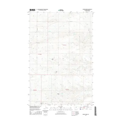
2017 Map of Bakers Spring
USGS Topo · Published 2017About this map
Bakers Spring and Sulphur Spring anchor this portion of Fergus County, where the high prairie begins its descent into a complex system of drainage coulees. The landscape is defined by the Peck Hills and the winding course of Sourdough Cr, showing a remote ranching territory reliant on these vital water sources. The survey reveals a network of deep-cut ravines including Sawmill Coulee, Deadman Coulee, and Murphy Coulee, which flow toward the larger Armells Cr in the southeast. This topography dictated the placement of early travel routes like Knox Ridge Rd and Whitmore Rd, which follow the higher, flatter ground to avoid the sharp breaks of the Burnt Timber Coulee and surrounding draws.
Find a feature on this map
15 named features on this map. Tap any name to fly to it.
Don’t see what you’re looking for? This feature index may not catch every label — zoom into the map to look around manually.
Map Details
Editions of this 2017 Bakers Spring Map
This is the sole edition of this map. No revisions or reprints were ever made.
Other maps of this area

1943 · Landusky
USGS Topo · 1:125,000

1954 · Baker Monument
USGS Topo · 1:24,000

1954 · Lewistown
USGS Topo · 1:250,000

1959 · Lewistown
USGS Topo · 1:250,000

1978 · Lewistown
USGS Topo · 1:100,000

1984 · Zortman
USGS Topo · 1:100,000

1985 · The Horse Ranch
USGS Topo · 1:24,000

1985 · Thompson Coulee
USGS Topo · 1:24,000

1985 · Woodhawk Hill
USGS Topo · 1:24,000
1985 · Roy NW
USGS Topo · 1:24,000