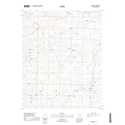
2017 Map of Bakersfield
USGS Topo · Published 2017About this map
Bakersfield sits at the heart of this Southern Missouri landscape, where the terrain is defined by a dense network of hollows and ridges typical of the Ozark Plateau. The settlement of Elijah anchors the northern portion of the quadrangle, connected to the surrounding countryside by numerous county roads like Co RD 540 and Co RD 580. Water is a defining element of the geography, with the North Fork River appearing in the northwest and the backwaters of Norfork Lake reaching into the southwest near Cedar Hollow. The map reveals several natural springs, including Taylor Spring and Spoon Spring near Elijah, and Bluff Spring just north of Bakersfield. Local history is preserved through named landmarks such as White Oak Cem and Fore Cem, while the descriptive names of landforms like Hasty Pudding Hollow and Hickory Stump Hollow reflect the traditional character of the region's rural topography.
Find a feature on this map
92 named features on this map. Tap any name to fly to it.
Don’t see what you’re looking for? This feature index may not catch every label — zoom into the map to look around manually.
Map Details
Editions of this 2017 Bakersfield Map
This is the sole edition of this map. No revisions or reprints were ever made.
Other maps of this area

1890 · Mountain Home
USGS Topo · 1:125,000

1891 · Mountain Home
USGS Topo · 1:125,000

1894 · Mountain Home
USGS Topo · 1:125,000

1934 · Gainesville
USGS Topo · 1:48,000

1940 · Gainesville
USGS Topo · 1:62,500

1944 · Cureall
USGS Topo · 1:62,500

1945 · Harrison
USGS Topo · 1:250,000

1946 · Cureall
USGS Topo · 1:62,500

1949 · Harrison
USGS Topo · 1:250,000

1954 · Harrison
USGS Topo · 1:250,000