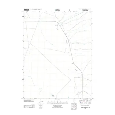
2012 Map of Baking Powder Flat
USGS Topo · Published 2012About this map
Harbecke Ranch, Robinson Ranch, and Yelland Ranch anchor the northern landscape of this White Pine County basin, illustrating a settlement pattern defined by isolated agricultural outposts. The water network is critical to this high-desert environment, with Spring Creek and Shingle Creek descending from the surrounding heights toward the flatlands. Further south, additional family operations like the Kerr Ranch and Kirkeby Ranch follow the valley floor, often positioned near essential water sources such as Worthington Spring or the moist grounds of Scottys Meadow. The local infrastructure is sparse, characterized by several designated routes including Co RD 39 and Lincoln Canyon Rd, which provide the primary connective tissue between these remote holdings and the broader region. This 2012 survey captures a snapshot of a working landscape where geography and survival are inextricably linked to rare hydrologic features like The Seep.
Find a feature on this map
19 named features on this map. Tap any name to fly to it.
Don’t see what you’re looking for? This feature index may not catch every label — zoom into the map to look around manually.
Map Details
Editions of this 2012 Baking Powder Flat Map
This is the sole edition of this map. No revisions or reprints were ever made.
Other maps of this area

1948 · Wheeler Peak
USGS Topo · 1:62,500

1950 · Wheeler Peak
USGS Topo · 1:62,500

1952 · Ely
USGS Topo · 1:125,000

1956 · Lund
USGS Topo · 1:250,000

1956 · Ely
USGS Topo · 1:250,000

1959 · Ely
USGS Topo · 1:250,000

1959 · Sacramento Pass
USGS Topo · 1:62,500

1959 · Connors Pass
USGS Topo · 1:62,500

1960 · Lund
USGS Topo · 1:250,000

1963 · Ely
USGS Topo · 1:250,000