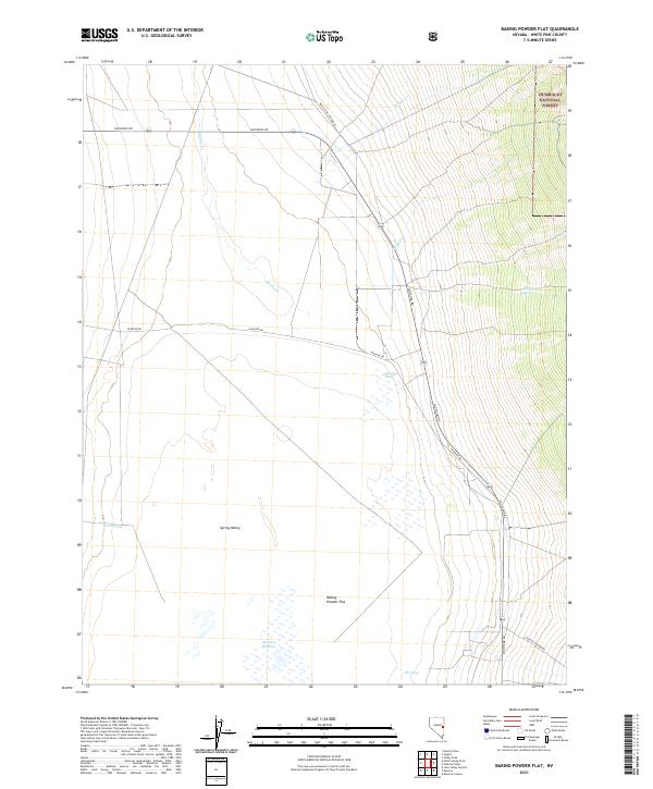
2021 Map of Baking Powder Flat
USGS Topo · Published 2021About this map
Spring Valley dominates this high-altitude basin, where the expansive salt-crusted expanse of Baking Powder Flat serves as a stark natural landmark. This 2021 survey documents a landscape of hydrology and grazing history, defined by ephemeral water sources and seasonal meadows. In the eastern portion of the sheet, the terrain rises sharply into the Humboldt National Forest, where drainages like Shingle Cr and Ridge Cr emerge from the mountain slopes. The floor of the valley is punctuated by vital watering points such as Shoshone Ponds, The Seep, and Scotty Meadow, which have historically supported livestock and wildlife in this arid environment. A network of unpaved corridors, including Shoshone Rd and Highline Rd, provide the primary access through the basin, following long-established routes between the Snake Range and the Schell Creek Range.
Find a feature on this map
20 named features on this map. Tap any name to fly to it.
Don’t see what you’re looking for? This feature index may not catch every label — zoom into the map to look around manually.
Map Details
Editions of this 2021 Baking Powder Flat Map
This is the sole edition of this map. No revisions or reprints were ever made.
Other maps of this area

1948 · Wheeler Peak
USGS Topo · 1:62,500

1950 · Wheeler Peak
USGS Topo · 1:62,500

1952 · Ely
USGS Topo · 1:125,000

1956 · Lund
USGS Topo · 1:250,000

1956 · Ely
USGS Topo · 1:250,000

1959 · Ely
USGS Topo · 1:250,000

1959 · Sacramento Pass
USGS Topo · 1:62,500

1959 · Connors Pass
USGS Topo · 1:62,500

1960 · Lund
USGS Topo · 1:250,000

1963 · Ely
USGS Topo · 1:250,000