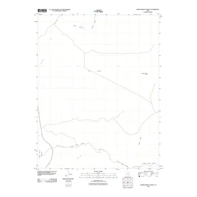
2010 Map of Baking Skillet Knoll
USGS Topo · Published 2010About this map
Baking Skillet Knoll rises as a prominent landmark above the vast expanse of the Burr Desert, illustrating the character of the southeastern Utah landscape in 2010. The terrain is defined by an intricate network of seasonal drainages, including Granite Wash and Beaver Wash, which converge through Beaver Canyon. These natural corridors reveal the critical role of intermittent water sources in this arid environment, marked by isolated features like Pool Spring and Dell Seep.
Find a feature on this map
12 named features on this map. Tap any name to fly to it.
Don’t see what you’re looking for? This feature index may not catch every label — zoom into the map to look around manually.
Map Details
Editions of this 2010 Baking Skillet Knoll Map
This is the sole edition of this map. No revisions or reprints were ever made.
Other maps of this area

1885 · San Rafael
USGS Topo · 1:250,000

1952 · Orange Cliffs 3 SW
USGS Topo · 1:24,000

1952 · Mount Ellen 4 SW
USGS Topo · 1:24,000

1952 · Mt. Ellen 4 NW
USGS Topo · 1:24,000

1952 · Bull Mountain
USGS Topo · 1:62,500

1953 · Orange Cliffs 3 NW
USGS Topo · 1:24,000

1953 · Fiddler Butte
USGS Topo · 1:62,500

1954 · Mt. Ellen 1 SW
USGS Topo · 1:24,000

1956 · Salina
USGS Topo · 1:250,000

1960 · Salina
USGS Topo · 1:250,000