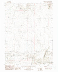
1988 Map of Baking Skillet Knoll
USGS Topo · Published 1988About this map
Burr Desert dominates the landscape of this 1988 provisional survey, showing a remote section of the Utah high country where the border between Wayne and Garfield Counties meets. The map documents a rugged drainage system defined by deep incisions like Beaver Canyon and the winding course of Poison Spring Wash. The topography shifts from the flat expanses of the desert to the elevated Poison Spring Benches in the south, where the terrain falls away into the complex network of Poison Spring Canyon. Significant landmarks such as Baking Skillet Knoll and the narrow corridor of the Swale provide navigational anchors in an area where water sources are vital but scarce, represented here by isolated points like Pool Spring and Dell Seep. This map is essential for understanding the hydrological patterns of Granite Wash and Butler Wash before modern environmental changes.
Find a feature on this map
13 named features on this map. Tap any name to fly to it.
Don’t see what you’re looking for? This feature index may not catch every label — zoom into the map to look around manually.
Map Details
Editions of this 1988 Baking Skillet Knoll Map
This is the sole edition of this map. No revisions or reprints were ever made.
Other maps of this area

1885 · San Rafael
USGS Topo · 1:250,000

1952 · Orange Cliffs 3 SW
USGS Topo · 1:24,000

1952 · Mount Ellen 4 SW
USGS Topo · 1:24,000

1952 · Mt. Ellen 4 NW
USGS Topo · 1:24,000

1952 · Bull Mountain
USGS Topo · 1:62,500

1953 · Orange Cliffs 3 NW
USGS Topo · 1:24,000

1953 · Fiddler Butte
USGS Topo · 1:62,500

1954 · Mt. Ellen 1 SW
USGS Topo · 1:24,000

1956 · Salina
USGS Topo · 1:250,000

1960 · Salina
USGS Topo · 1:250,000