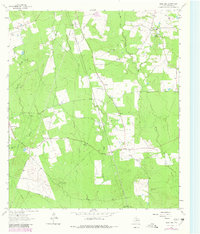
1963 Map of Bald Hill
USGS Topo · Published 1980About this map
Bald Hill and the surrounding Angelina County timberlands appear here as they were documented in the early 1960s and updated through 1980. This East Texas landscape is defined by the winding paths of Biloxi Creek and Bear Creek, which cut through a mosaic of woodland and clearings. Small rural communities like Beulah and Prairie Grove serve as local anchors, connected by a network of roads and numerous pipelines that signal the region's energy infrastructure. The industrial presence is further evidenced by the Ginter Oil Field and scattered oil wells throughout the quadrangle.
Find a feature on this map
23 named features on this map. Tap any name to fly to it.
Don’t see what you’re looking for? This feature index may not catch every label — zoom into the map to look around manually.
Map Details
Editions of this 1963 Bald Hill Map
2 editions found
Other maps of this area

1927 · Lufkin 4-c
USGS Topo · 1:24,000

1928 · Lufkin 4-d
USGS Topo · 1:24,000

1932 · Manning
USGS Topo · 1:62,500

1949 · Lufkin
USGS Topo · 1:62,500

1949 · Lufkin
USGS Topo · 1:24,000

1949 · Huntington
USGS Topo · 1:24,000

1949 · Keltys
USGS Topo · 1:24,000

1950 · Keltys
USGS Topo · 1:24,000

1950 · Lufkin
USGS Topo · 1:24,000

1950 · Huntington
USGS Topo · 1:24,000