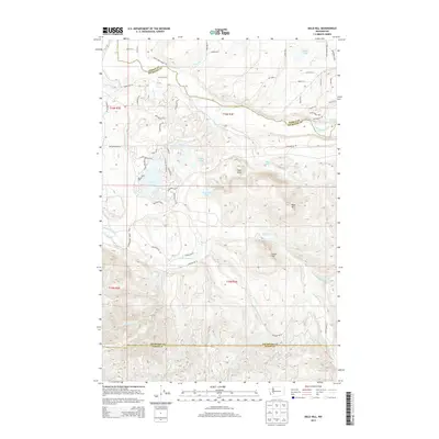
2013 Map of Bald Hill
USGS Topo · Published 2013About this map
The Nisqually River and Deschutes River define the hydrography of this Pierce County landscape, carving through a region marked by significant elevation changes and glacial lake formations. High points like Bald Hill and Green Hill rise above the surrounding terrain, while unique geological features such as Fossil Rock provide landmarks for the area. The map illustrates a transition between the northern lowlands, featuring Kreger Lake and Tanwax Cr, and the more complex drainage systems of the south.
Find a feature on this map
69 named features on this map. Tap any name to fly to it.
Don’t see what you’re looking for? This feature index may not catch every label — zoom into the map to look around manually.
Map Details
Editions of this 2013 Bald Hill Map
This is the sole edition of this map. No revisions or reprints were ever made.
Other maps of this area

1916 · Chehalis
USGS Topo · 1:125,000

1937 · Eatonville
USGS Topo · 1:125,000

1941 · Tanwax Lake
USGS Topo · 1:62,500

1943 · Willapa
USGS Topo · 1:62,500

1944 · Yelm
USGS Topo · 1:62,500

1944 · Ohop Valley
USGS Topo · 1:62,500

1949 · Ohop Valley
USGS Topo · 1:62,500

1949 · Yelm
USGS Topo · 1:62,500

1953 · Hoquiam
USGS Topo · 1:250,000

1954 · Onalaska
USGS Topo · 1:62,500