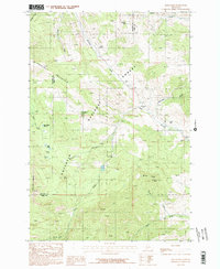
1987 Map of Bald Knob
USGS Topo · Published 1987About this map
The high ridges and deep gulches of the Gallatin Range define this 1987 provisional survey, which straddles the border of Gallatin and Park counties. This landscape is a working mountain environment where mining and forestry interests left a clear imprint on the land. Remnants of early industrial activity are preserved through the locations of the Kountz Mine, Harrison Mine, and the Old Russell Mill, situated along the drainages of Meadow Creek and its tributaries.
Find a feature on this map
28 named features on this map. Tap any name to fly to it.
Don’t see what you’re looking for? This feature index may not catch every label — zoom into the map to look around manually.
Map Details
Editions of this 1987 Bald Knob Map
2 editions found
Other maps of this area

1891 · Livingston
USGS Topo · 1:250,000

1893 · Livingston
USGS Topo · 1:250,000

1947 · Bozeman
USGS Topo · 1:250,000

1948 · Bozeman
USGS Topo · 1:250,000

1951 · Bozeman Pass
USGS Topo · 1:62,500

1951 · Hoppers
USGS Topo · 1:24,000

1951 · Chimney Rock
USGS Topo · 1:24,000

1955 · Bozeman
USGS Topo · 1:250,000

1955 · Emigrant
USGS Topo · 1:62,500

1955 · Fridley Peak
USGS Topo · 1:62,500