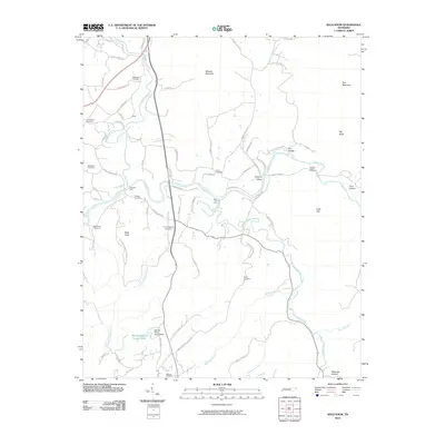
2010 Map of Bald Knob
USGS Topo · Published 2010About this map
Milksick Mountain and Pine Mountain dominate the northern landscape in this Tennessee survey, where the Calfkiller River and Caney Fork converge. The terrain is defined by its numerous family and community cemeteries, including Bethlehem Cemetery, Old Bethel Cemetery, and Fraziers Chapel Cemetery, which provide a clear record of local settlement patterns. Water access remains central to the geography, evidenced by historic crossing points like Plumlees Ford and River Hill Ford. To the south, the Spencer Water Supply Lake and its accompanying Spencer Water Supply Dam represent modern infrastructure supporting the community. The map also records localized features like Fox Hollow and Waterfall Hollow, alongside the winding paths of Cane Creek and Millstone Branch.
Find a feature on this map
71 named features on this map. Tap any name to fly to it.
Don’t see what you’re looking for? This feature index may not catch every label — zoom into the map to look around manually.
Map Details
Editions of this 2010 Bald Knob Map
This is the sole edition of this map. No revisions or reprints were ever made.
Other maps of this area

1892 · Pikeville
USGS Topo · 1:125,000

1893 · Mc Minnville
USGS Topo · 1:125,000

1895 · Mc Minnville
USGS Topo · 1:125,000

1895 · Pikeville
USGS Topo · 1:125,000

1943 · Cookeville
USGS Topo · 1:100,000

1944 · Cookeville
USGS Topo · 1:100,000

1953 · Chattanooga
USGS Topo · 1:250,000

1954 · De Rossett
USGS Topo · 1:24,000

1954 · Sparta
USGS Topo · 1:24,000
1954 · Lonewood
USGS Topo · 1:24,000