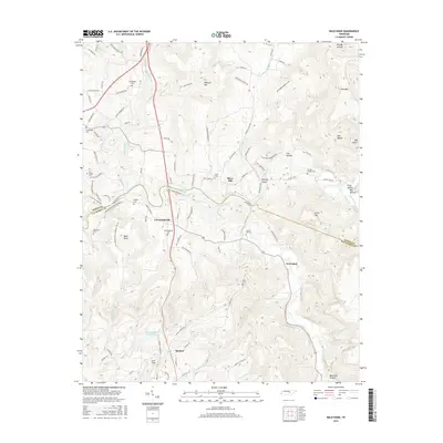
2016 Map of Bald Knob
USGS Topo · Published 2016About this map
Spencer serves as a focal point for this survey of the Van Buren and White County line, situated just south of the winding Caney Fork and Great Falls Lake. The landscape is defined by the transition from the plateaus of Bald Knob and Milksick Mtn to the deep hollows of the river valleys. A dense network of local routes, such as Hodges Ferry Rd and Double Bridges Rd, connects small communities like Cummingsville and River Hill. This region is a significant area for genealogical research, as evidenced by the numerous family and community burial grounds documented here, including Gravel Hill Cem, Fraziers Chapel Cem, and Sparkman Cem. The hydrography of the area is particularly complex, with the Calfkiller River and various branches like Hickory Valley Br carving through the terrain toward the larger waterways.
Find a feature on this map
98 named features on this map. Tap any name to fly to it.
Don’t see what you’re looking for? This feature index may not catch every label — zoom into the map to look around manually.
Map Details
Editions of this 2016 Bald Knob Map
This is the sole edition of this map. No revisions or reprints were ever made.
Other maps of this area

1892 · Pikeville
USGS Topo · 1:125,000

1893 · Mc Minnville
USGS Topo · 1:125,000

1895 · Mc Minnville
USGS Topo · 1:125,000

1895 · Pikeville
USGS Topo · 1:125,000

1943 · Cookeville
USGS Topo · 1:100,000

1944 · Cookeville
USGS Topo · 1:100,000

1953 · Chattanooga
USGS Topo · 1:250,000

1954 · De Rossett
USGS Topo · 1:24,000

1954 · Sparta
USGS Topo · 1:24,000
1954 · Lonewood
USGS Topo · 1:24,000