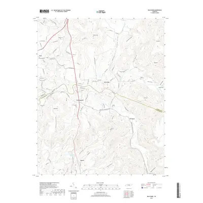
2019 Map of Bald Knob
USGS Topo · Published 2019About this map
Spencer anchors the southern portion of this landscape where the plateau meets the drainage of Cane Creek. The area is defined by its deep coves and elevated knobs, notably Bald Knob and Milksick Mtn, which overlook a network of small agricultural settlements. The transition between White and Van Buren counties is marked by the winding course of the Calfkiller River and the Caney Fork. For those researching local family history, the map provides precise locations for numerous community burial sites, including Bethlehem Cem, Gravel Hill Cem, and the Fraziers Chapel Cem. The concentration of these cemeteries alongside small hamlets like Cummingsville and Sweetgum reflects the enduring rural settlement patterns of the Cumberland Plateau region, sustained by local water sources like the Spencer Water Supply Lake.
Find a feature on this map
103 named features on this map. Tap any name to fly to it.
Don’t see what you’re looking for? This feature index may not catch every label — zoom into the map to look around manually.
Map Details
Editions of this 2019 Bald Knob Map
This is the sole edition of this map. No revisions or reprints were ever made.
Other maps of this area

1892 · Pikeville
USGS Topo · 1:125,000

1893 · Mc Minnville
USGS Topo · 1:125,000

1895 · Mc Minnville
USGS Topo · 1:125,000

1895 · Pikeville
USGS Topo · 1:125,000

1943 · Cookeville
USGS Topo · 1:100,000

1944 · Cookeville
USGS Topo · 1:100,000

1953 · Chattanooga
USGS Topo · 1:250,000

1954 · De Rossett
USGS Topo · 1:24,000

1954 · Sparta
USGS Topo · 1:24,000
1954 · Lonewood
USGS Topo · 1:24,000