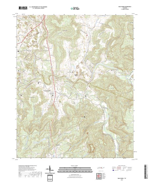
2022 Map of Bald Knob
USGS Topo · Published 2022About this map
Spencer and its northern surroundings sit at the confluence of several key Tennessee waterways, where the Caney Fork and Cane Creek wind through a landscape punctuated by named heights like Bald Knob and Milksick Mtn. The terrain is characterized by deeply cut hollows and coves, including Lost Cove and Waterfall Hollow, which dictate the winding paths of rural routes like Cummingsville and Sparkman Rd. Local family history is well-preserved through numerous small burial grounds such as Sparkman Cem, Hodges Cem, and Greenwood Cem, often situated near small community centers like Cummingsville and River Hill. The rural social fabric is further evidenced by long-standing congregations at Bethlehem Church and Frasers Chapel United Methodist Church. The presence of the Spencer Water Supply Lake indicates modern infrastructure needs within this predominantly agricultural and timber-oriented landscape of White and Van Buren counties.
Find a feature on this map
108 named features on this map. Tap any name to fly to it.
Don’t see what you’re looking for? This feature index may not catch every label — zoom into the map to look around manually.
Map Details
Editions of this 2022 Bald Knob Map
This is the sole edition of this map. No revisions or reprints were ever made.
Other maps of this area

1892 · Pikeville
USGS Topo · 1:125,000

1893 · Mc Minnville
USGS Topo · 1:125,000

1895 · Mc Minnville
USGS Topo · 1:125,000

1895 · Pikeville
USGS Topo · 1:125,000

1943 · Cookeville
USGS Topo · 1:100,000

1944 · Cookeville
USGS Topo · 1:100,000

1953 · Chattanooga
USGS Topo · 1:250,000

1954 · De Rossett
USGS Topo · 1:24,000

1954 · Sparta
USGS Topo · 1:24,000
1954 · Lonewood
USGS Topo · 1:24,000