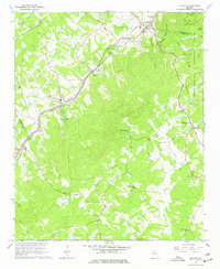
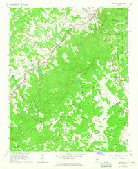
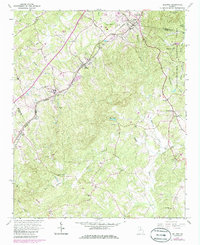
1964 Map of Baldwin
USGS Topo · Published 1977About this map
Alto and Baldwin serve as the primary rail-oriented hubs along the Southern line in this mid-1960s survey of the Georgia foothills. The landscape is characterized by a dense network of country churches and family cemeteries, including Mt Zion Ch, Mt Sinai Ch, and Wynn Cem, indicating a deeply rooted rural community structure. Notable institutional presence is found at the State Industrial Institute south of Alto, while the eastern portion of the map transitions into the protected timberlands of the Chattahoochee National Forest.
Find a feature on this map
47 named features on this map. Tap any name to fly to it.
Don’t see what you’re looking for? This feature index may not catch every label — zoom into the map to look around manually.
Map Details
Editions of this 1964 Baldwin Map
3 editions found
Other maps of this area

1886 · Dahlonega
USGS Topo · 1:125,000

1886 · Walhalla
USGS Topo · 1:125,000

1891 · Gainesville
USGS Topo · 1:125,000

1891 · Carnesville
USGS Topo · 1:125,000

1892 · Dahlonega
USGS Topo · 1:125,000

1892 · Walhalla
USGS Topo · 1:125,000

1896 · Walhalla
USGS Topo · 1:125,000

1896 · Dahlonega
USGS Topo · 1:125,000

1903 · Dahlonega
USGS Topo · 1:125,000

1954 · Greenville
USGS Topo · 1:250,000