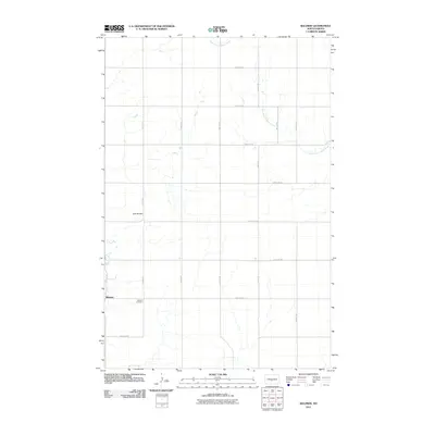
2011 Map of Baldwin
USGS Topo · Published 2011About this map
Baldwin serves as the primary hub of this Burleigh County landscape, oriented around a grid of rural sections. The settlement is anchored locally by the Baldwin Cemetery to the south and Burnt Creek to the west. The terrain is characterized by the prominent Twin Buttes, which rise above the surrounding prairie between the township roads. Meandering drainages, most notably the West Branch Apple Creek, carve through the eastern half of the quadrangle, illustrating the natural drainage patterns of the Missouri Plateau. This 2011 survey reflects the intersection of systematic sectional surveying—evidenced by thoroughfares like 41st St NE and 227th Ave NE—and the undulating topography of central North Dakota.
Find a feature on this map
19 named features on this map. Tap any name to fly to it.
Don’t see what you’re looking for? This feature index may not catch every label — zoom into the map to look around manually.
Map Details
Editions of this 2011 Baldwin Map
This is the sole edition of this map. No revisions or reprints were ever made.
Other maps of this area

1907 · Bismarck
USGS Topo · 1:125,000

1950 · Wilton
USGS Topo · 1:62,500

1951 · Bismarck
USGS Topo · 1:62,500

1951 · Menoken
USGS Topo · 1:62,500

1954 · Bismarck
USGS Topo · 1:250,000

1954 · McClusky
USGS Topo · 1:250,000

1958 · Bismarck
USGS Topo · 1:250,000

1958 · McClusky
USGS Topo · 1:250,000
1962 · Burnt Butte
USGS Topo · 1:24,000

1966 · Wilton SE
USGS Topo · 1:24,000