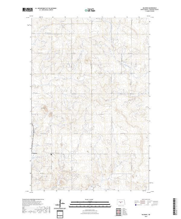
2024 Map of Baldwin
USGS Topo · Published 2024About this map
Baldwin serves as the primary focal point of this Burleigh County survey, situated in the high plains of North Dakota. The landscape is defined by the gentle drainage of the West Branch Apple Creek, which meanders through the eastern portions of the quadrangle. A distinct topographical shift occurs at Twin Buttes, providing a vertical contrast to the surrounding section lines and agricultural grid. The settlement pattern remains strictly tied to the township and range system, with named thoroughfares like 201st Ave NE and 41st St NE providing a precise grid for local commerce and rural homesteads. For those researching local heritage, the Baldwin Cem is a prominent landmark located just east of the main townsite, marking the center of this long-standing prairie community.
Find a feature on this map
21 named features on this map. Tap any name to fly to it.
Don’t see what you’re looking for? This feature index may not catch every label — zoom into the map to look around manually.
Map Details
Editions of this 2024 Baldwin Map
This is the sole edition of this map. No revisions or reprints were ever made.
Other maps of this area

1907 · Bismarck
USGS Topo · 1:125,000

1950 · Wilton
USGS Topo · 1:62,500

1951 · Bismarck
USGS Topo · 1:62,500

1951 · Menoken
USGS Topo · 1:62,500

1954 · Bismarck
USGS Topo · 1:250,000

1954 · McClusky
USGS Topo · 1:250,000

1958 · Bismarck
USGS Topo · 1:250,000

1958 · McClusky
USGS Topo · 1:250,000
1962 · Burnt Butte
USGS Topo · 1:24,000

1966 · Wilton SE
USGS Topo · 1:24,000