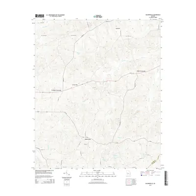
2014 Map of Baldwinville
USGS Topo · Published 2014About this map
Baldwinville serves as a central hub for this rural stretch of Georgia, where numerous local roads converge near the Adams Cem. The landscape is defined by a dense network of watercourses, including Richland Cr, Mill Cr, and Potters Cr, which carve through the terrain between the small settlements of Ypsilanti and Poplar Crossroads. The historical road pattern is evident in the alignment of Ga-22 and Ga-208, connecting these crossroads communities.
Find a feature on this map
37 named features on this map. Tap any name to fly to it.
Don’t see what you’re looking for? This feature index may not catch every label — zoom into the map to look around manually.
Map Details
Editions of this 2014 Baldwinville Map
This is the sole edition of this map. No revisions or reprints were ever made.
Other maps of this area

1907 · Talbotton
USGS Topo · 1:125,000

1934 · Warm Springs
USGS Topo · 1:62,500

1935 · Thomaston
USGS Topo · 1:48,000

1936 · Warm Springs
USGS Topo · 1:62,500

1939 · Thomaston
USGS Topo · 1:62,500

1950 · Talbotton
USGS Topo · 1:24,000

1950 · Geneva
USGS Topo · 1:24,000

1950 · Talbotton
USGS Topo · 1:62,500

1955 · Talbotton
USGS Topo · 1:24,000
1955 · Geneva
USGS Topo · 1:24,000