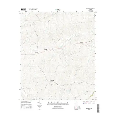
2017 Map of Baldwinville
USGS Topo · Published 2017About this map
Po Biddy Crossroads and Baldwinville anchor this rural landscape in the western reaches of Georgia, where the terrain is intricately carved by the tributaries of the Black River and Patsiliga Cr. The map reveals a deeply established network of local roads such as Old Wire Rd and Pobiddy Rd, which connect small communities like Centerville and Ypsilanti. For genealogists, the presence of Adams Cem and numerous family-named roads, including Howard Neal Rd and George Smith Rd, provides specific clues for tracing property and ancestry. The hydrology is dominated by Richland Cr and Potters Cr, alongside smaller water bodies like Matthews Lake East and Floyds Lake, which define the low-lying wetlands and drainage patterns of the region.
Find a feature on this map
43 named features on this map. Tap any name to fly to it.
Don’t see what you’re looking for? This feature index may not catch every label — zoom into the map to look around manually.
Map Details
Editions of this 2017 Baldwinville Map
This is the sole edition of this map. No revisions or reprints were ever made.
Other maps of this area

1907 · Talbotton
USGS Topo · 1:125,000

1934 · Warm Springs
USGS Topo · 1:62,500

1935 · Thomaston
USGS Topo · 1:48,000

1936 · Warm Springs
USGS Topo · 1:62,500

1939 · Thomaston
USGS Topo · 1:62,500

1950 · Talbotton
USGS Topo · 1:24,000

1950 · Geneva
USGS Topo · 1:24,000

1950 · Talbotton
USGS Topo · 1:62,500

1955 · Talbotton
USGS Topo · 1:24,000
1955 · Geneva
USGS Topo · 1:24,000