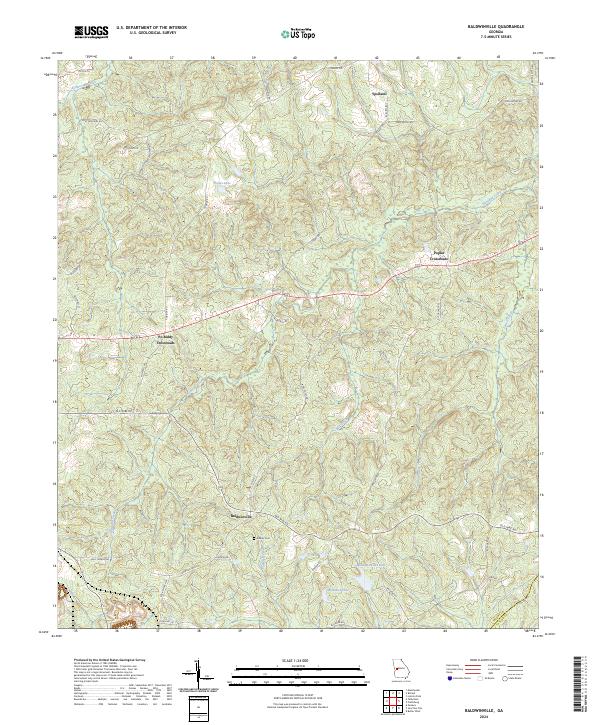
2024 Map of Baldwinville
USGS Topo · Published 2024About this map
Baldwinville serves as a central point in this part of Georgia, where the terrain is defined by the branching waters of Richland Creek and Patsiliga Creek. The map documents a landscape of traditional rural intersections, including the curiously named Po Biddy Crossroads and Poplar Crossroads. Historic travel patterns are evident in the path of Old Wire Rd, a naming convention often associated with early telegraph lines that once linked rural communities.
Find a feature on this map
40 named features on this map. Tap any name to fly to it.
Don’t see what you’re looking for? This feature index may not catch every label — zoom into the map to look around manually.
Map Details
Editions of this 2024 Baldwinville Map
This is the sole edition of this map. No revisions or reprints were ever made.
Other maps of this area

1907 · Talbotton
USGS Topo · 1:125,000

1934 · Warm Springs
USGS Topo · 1:62,500

1935 · Thomaston
USGS Topo · 1:48,000

1936 · Warm Springs
USGS Topo · 1:62,500

1939 · Thomaston
USGS Topo · 1:62,500

1950 · Talbotton
USGS Topo · 1:24,000

1950 · Geneva
USGS Topo · 1:24,000

1950 · Talbotton
USGS Topo · 1:62,500

1955 · Talbotton
USGS Topo · 1:24,000
1955 · Geneva
USGS Topo · 1:24,000