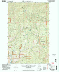
2004 Map of Baldy Mountain
USGS Topo · Published 2008About this map
Ardenvoir and the small settlement of Bisping sit along the winding Entiat River in this 2004 revision of the Chelan County high country. The landscape is defined by the steep drainage systems of the Chelan Mountains, where numerous named canyons like Switchback Canyon, Wilkinson Canyon, and McKenzie Canyon cut through the Wenatchee National Forest. This map reflects a transition into the 21st century, showing modern land management boundaries for the Entiat State Wildlife Area alongside older natural resource markers.
Find a feature on this map
43 named features on this map. Tap any name to fly to it.
Don’t see what you’re looking for? This feature index may not catch every label — zoom into the map to look around manually.
Map Details
Editions of this 2004 Baldy Mountain Map
This is the sole edition of this map. No revisions or reprints were ever made.
Other maps of this area

1901 · Chelan
USGS Topo · 1:125,000

1957 · Wenatchee
USGS Topo · 1:250,000

1968 · Entiat
USGS Topo · 1:24,000

1968 · Tyee Mtn.
USGS Topo · 1:24,000
1968 · Stormy Mtn.
USGS Topo · 1:24,000

1968 · Ardenvoir
USGS Topo · 1:24,000

1968 · Baldy Mtn
USGS Topo · 1:24,000
1968 · Chumstick Mtn
USGS Topo · 1:24,000
1968 · Brief
USGS Topo · 1:24,000

1968 · Winesap
USGS Topo · 1:24,000