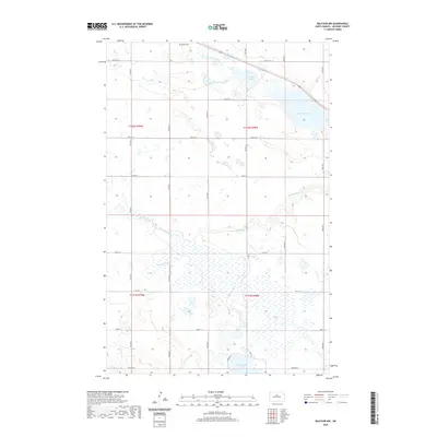
2020 Map of Balfour NW
USGS Topo · Published 2020About this map
Bergen Cem stands near the northern boundary of this McHenry County landscape, a quiet testament to the early settlers who carved homesteads from the prairie. The terrain is defined by a complex glacial drainage pattern, where the winding Wintering River and Spring Coulee meander through a series of significant water bodies. Large basins such as Paulson Lake, Cottonwood Lake, and the expansive Connia Slough dominate the eastern and northern reaches. The land is organized by a strict section-line road network, with routes like 38th St N and 35th St N bisecting the township lines of T152N and T151N. This modern survey illustrates how the contemporary agricultural grid coexists with the natural hydrology of the central North Dakota plains.
Find a feature on this map
19 named features on this map. Tap any name to fly to it.
Don’t see what you’re looking for? This feature index may not catch every label — zoom into the map to look around manually.
Map Details
Editions of this 2020 Balfour NW Map
This is the sole edition of this map. No revisions or reprints were ever made.
Other maps of this area

1929 · Kongsberg
USGS Topo · 1:62,500

1929 · Balfour
USGS Topo · 1:62,500

1948 · Voltaire
USGS Topo · 1:24,000

1948 · Velva
USGS Topo · 1:62,500

1949 · Voltaire
USGS Topo · 1:24,000

1951 · Velva
USGS Topo · 1:62,500

1954 · Minot
USGS Topo · 1:250,000

1954 · McClusky
USGS Topo · 1:250,000

1957 · Bergen
USGS Topo · 1:24,000

1957 · Karlsruhe
USGS Topo · 1:24,000