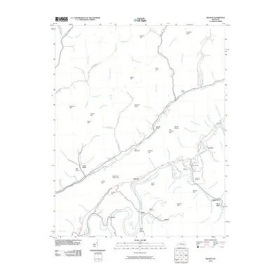
2010 Map of Balkan
USGS Topo · Published 2010About this map
The Cumberland River and Straight Creek carve their paths through this portion of Bell County, dictating the development of several small riverside communities. Along the southern bend of the river, Tejay and Balkan are connected by local roads such as Collies Rd, while the settlement of Kettle Island sits further west near the Kettle Island Cemetery. The landscape is defined by its ridge-and-hollow topography, featuring numerous gaps like Moccasin Gap and Bingham Gap that provided natural transit points through the hills.
Find a feature on this map
99 named features on this map. Tap any name to fly to it.
Don’t see what you’re looking for? This feature index may not catch every label — zoom into the map to look around manually.
Map Details
Editions of this 2010 Balkan Map
This is the sole edition of this map. No revisions or reprints were ever made.
Other maps of this area

1886 · Cumberland Gap
USGS Topo · 1:125,000

1887 · Jonesville
USGS Topo · 1:125,000

1888 · Cumberland Gap
USGS Topo · 1:125,000

1891 · Cumberland Gap
USGS Topo · 1:125,000

1891 · Jonesville
USGS Topo · 1:125,000

1903 · Harlan
USGS Topo · 1:48,000

1903 · Pineville
USGS Topo · 1:48,000

1903 · Middlesboro
USGS Topo · 1:48,000

1916 · Harlan
USGS Topo · 1:48,000

1919 · Harlan
USGS Topo · 1:62,500