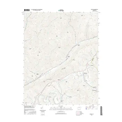
2016 Map of Balkan
USGS Topo · Published 2016About this map
Pine Mountain dominates the center of this mountain landscape, which is divided by the winding course of the Cumberland River and Straight Creek. The settlement pattern follows the narrow valley floors, where communities like Balkan, Callaway, and Miracle are linked by local routes such as Martha Lock Brock Rd and Peach Blossom Rd. This 2016 survey documents a terrain deeply etched by family-named hollows and gaps, including Blind John Taylor Gap and Moccasin Gap. Local history is preserved in numerous upland cemeteries, such as the Kettle Island Cem and Tacket Hill Cem, which sit above the residential clusters and river bends. The map shows the distinct border between Bell Co and Harlan Co as it cuts across the ridges of the eastern Kentucky coalfields.
Find a feature on this map
93 named features on this map. Tap any name to fly to it.
Don’t see what you’re looking for? This feature index may not catch every label — zoom into the map to look around manually.
Map Details
Editions of this 2016 Balkan Map
This is the sole edition of this map. No revisions or reprints were ever made.
Other maps of this area

1886 · Cumberland Gap
USGS Topo · 1:125,000

1887 · Jonesville
USGS Topo · 1:125,000

1888 · Cumberland Gap
USGS Topo · 1:125,000

1891 · Cumberland Gap
USGS Topo · 1:125,000

1891 · Jonesville
USGS Topo · 1:125,000

1903 · Harlan
USGS Topo · 1:48,000

1903 · Pineville
USGS Topo · 1:48,000

1903 · Middlesboro
USGS Topo · 1:48,000

1916 · Harlan
USGS Topo · 1:48,000

1919 · Harlan
USGS Topo · 1:62,500