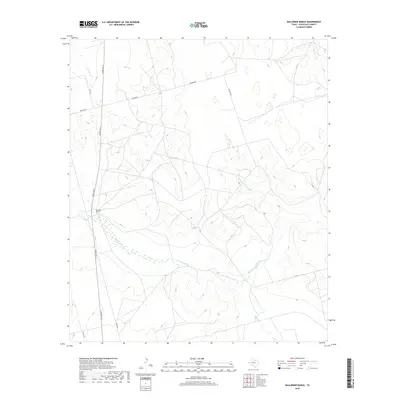
2019 Map of Ballinger Ranch
USGS Topo · Published 2019About this map
Ballinger Ranch serves as a primary landmark in this high plains landscape of Glasscock County, where the drainage patterns of the Concho River basin begin to take shape. The terrain is defined by a network of intermittent creek beds, including Polecat Cr and the various branches of the Apple Creek system. The confluence of W Fork Apple Cr and Middle Fork Apple Cr eventually forms Apple Cr as it flows toward the southeast. This 2019 survey documents a sparsely populated ranching region partitioned by a functional grid of local roads. Primary transit through the area is maintained via Ranch Rd 33, while named local routes such as Sherrod Rd, Ditto Rd, and Schafer Rd provide access to the expansive grazing lands that characterize this portion of West Texas.
Find a feature on this map
12 named features on this map. Tap any name to fly to it.
Don’t see what you’re looking for? This feature index may not catch every label — zoom into the map to look around manually.
Map Details
Editions of this 2019 Ballinger Ranch Map
This is the sole edition of this map. No revisions or reprints were ever made.
Other maps of this area

1941 · Morita
USGS Topo · 1:62,500

1941 · Big Spring South
USGS Topo · 1:62,500

1942 · Big Spring South
USGS Topo · 1:62,500

1949 · Morita
USGS Topo · 1:62,500

1954 · Big Spring
USGS Topo · 1:250,000

1954 · San Angelo
USGS Topo · 1:250,000

1958 · San Angelo
USGS Topo · 1:250,000

1958 · Big Spring
USGS Topo · 1:250,000

1963 · Ballinger Ranch
USGS Topo · 1:24,000

1963 · Currie Reservoir
USGS Topo · 1:24,000