2024 Map of Ballplay
USGS Topo · Published 2024About this map
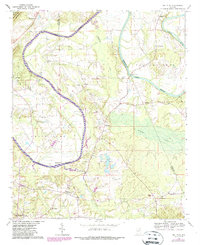
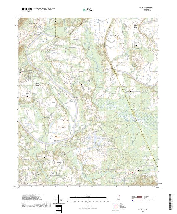
The Coosa River meanders through the landscape of northeastern Alabama, creating dramatic oxbows at Ballplay Bend, Coats Bend, and Pollard Bend. This river-defined geography historically dictated the location of vital crossings such as Baskin Ferry and Wood Ferry, connecting rural agricultural communities along its banks. To the northwest, the prominent rise of Shinbone Ridge overlooks a series of managed waters including the Thornton Lake chain, specifically Thornton Number 1 Lake through Thornton Number 6 Lake.
Find a feature on this map
123 named features on this map. Tap any name to fly to it.
Don’t see what you’re looking for? This feature index may not catch every label — zoom into the map to look around manually.
Map Details
Editions of this 2024 Ballplay Map
This is the sole edition of this map. No revisions or reprints were ever made.