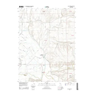
2015 Map of Balls Ferry
USGS Topo · Published 2015About this map
The Sacramento River carves through this northern California landscape, serving as the central artery for a region defined by its broad river plains and seasonal watercourses. Near the riverbanks, the Balls Ferry Fishing Resort and the Balls Ferry Bridge mark a historic crossing point that has long connected the area’s agricultural and recreational interests. To the north, the Stillwater Plains and Millville Plains sit above the river valley, characterized by a grid of rural roads like Dersch Rd and Millville Plains Rd. Cultural landmarks such as the Parkville Cemetery near Parkville provide essential points of interest for genealogists tracing local families. The southern portion of the map transitions into the Sacramento Valley, where the confluence of Battle Creek, Cottonwood Creek, and Patterson Cr creates a complex system of islands including Rancherie Island, Reading Island, and Bloody Island.
Find a feature on this map
91 named features on this map. Tap any name to fly to it.
Don’t see what you’re looking for? This feature index may not catch every label — zoom into the map to look around manually.
Map Details
Editions of this 2015 Balls Ferry Map
This is the sole edition of this map. No revisions or reprints were ever made.
Other maps of this area

1890 · Red Bluff
USGS Topo · 1:250,000

1894 · Red Bluff
USGS Topo · 1:250,000

1901 · Redding
USGS Topo · 1:125,000

1944 · Redding
USGS Topo · 1:62,500

1944 · Tuscan Buttes
USGS Topo · 1:62,500

1946 · Redding
USGS Topo · 1:62,500

1947 · Tuscan Buttes
USGS Topo · 1:62,500

1947 · Anderson
USGS Topo · 1:62,500

1948 · Anderson
USGS Topo · 1:62,500

1953 · Millville
USGS Topo · 1:62,500