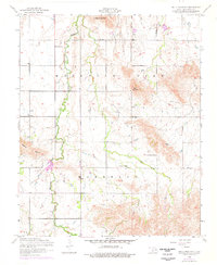
1956 Map of Bally Mountain
USGS Topo · Published 1976About this map
Bally Mountain and the surrounding peaks of Kiowa County define this landscape as it was surveyed in the mid-1950s and updated in the 1970s. The topography is dominated by dramatic elevations like Zodletone Mountain and the ridges of Mountain View, where the drainage patterns of Saddle Mountain Creek and Pecan Creek carve through the terrain. A small settlement footprint is visible in the area labeled Marshall, providing a focal point for researchers interested in the rural organization of this part of Oklahoma.
Find a feature on this map
9 named features on this map. Tap any name to fly to it.
Don’t see what you’re looking for? This feature index may not catch every label — zoom into the map to look around manually.
Map Details
Editions of this 1956 Bally Mountain Map
2 editions found
Other maps of this area

1949 · Cooperton
USGS Topo · 1:62,500

1950 · Saddle Mountain
USGS Topo · 1:62,500

1955 · Lawton
USGS Topo · 1:250,000

1955 · Clinton
USGS Topo · 1:250,000

1956 · Saddle Mountain
USGS Topo · 1:24,000

1956 · Cooperton
USGS Topo · 1:24,000

1956 · Alden
USGS Topo · 1:24,000

1956 · Bally Mountain
USGS Topo · 1:24,000

1956 · Unap Mountain
USGS Topo · 1:24,000

1956 · Meers
USGS Topo · 1:24,000