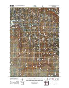
2011 Map of Balm Creek Reservoir
USGS Topo · Published 2011About this map
Sanger Mine and the Daddy Lode Mine anchor a landscape defined by its historical mining activity and complex water management. This region of Baker County is crisscrossed by an intricate drainage system including East Fork Goose Creek and West Fork Goose Creek, which feed into the central Goose Lake. The presence of the Balm Creek Dam and Balm Creek Reservoir reflects the engineered nature of this arid environment, providing essential water storage for a terrain marked by steep features like Dark Canyon and Red Ridge. To the south, additional infrastructure like the Saw Mill Gulch Dam and Grover Reservoir further illustrates the heavy reliance on controlled water sources. Small outposts and landmarks such as Goslin Corral and Forshey Meadow hint at a history of ranching and seasonal land use amidst the extractive industries.
Find a feature on this map
40 named features on this map. Tap any name to fly to it.
Don’t see what you’re looking for? This feature index may not catch every label — zoom into the map to look around manually.
Map Details
Editions of this 2011 Balm Creek Reservoir Map
This is the sole edition of this map. No revisions or reprints were ever made.
Other maps of this area

1901 · Baker City
USGS Topo · 1:125,000

1906 · Telocaset
USGS Topo · 1:125,000

1915 · Pine
USGS Topo · 1:125,000

1954 · Eagle Cap
USGS Topo · 1:62,500

1955 · Baker
USGS Topo · 1:250,000

1955 · Grangeville
USGS Topo · 1:250,000

1957 · Sparta
USGS Topo · 1:62,500

1959 · Baker
USGS Topo · 1:250,000

1959 · Grangeville
USGS Topo · 1:250,000

1965 · Flagstaff Butte
USGS Topo · 1:24,000