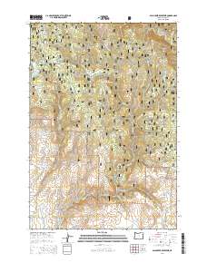
2014 Map of Balm Creek Reservoir
USGS Topo · Published 2014About this map
The Whitman National Forest dominates this landscape in Baker County, where a complex network of waterways and early water management infrastructure defines the terrain. The Balm Cr Reservoir and Goose Lake serve as central landmarks, supported by irrigation and drainage features like the Steward Ditch and Phillips Ditch. These human-made channels, alongside names like Gover Reservoir, suggest a history of managing the arid high country for ranching or mining needs. High points such as Red Knob and the prominent Red Ridge overlook deep incisions in the earth, including Excelsior Gulch and Dark Canyon. The presence of several springs, such as Union Spring and Surprise Spring, highlights the critical importance of reliable water sources in this mountainous environment. Farther south, the terrain opens into Forshey Meadow, tucked between the various forks of Goose Cr.
Find a feature on this map
51 named features on this map. Tap any name to fly to it.
Don’t see what you’re looking for? This feature index may not catch every label — zoom into the map to look around manually.
Map Details
Editions of this 2014 Balm Creek Reservoir Map
This is the sole edition of this map. No revisions or reprints were ever made.
Other maps of this area

1901 · Baker City
USGS Topo · 1:125,000

1906 · Telocaset
USGS Topo · 1:125,000

1915 · Pine
USGS Topo · 1:125,000

1954 · Eagle Cap
USGS Topo · 1:62,500

1955 · Baker
USGS Topo · 1:250,000

1955 · Grangeville
USGS Topo · 1:250,000

1957 · Sparta
USGS Topo · 1:62,500

1959 · Baker
USGS Topo · 1:250,000

1959 · Grangeville
USGS Topo · 1:250,000

1965 · Flagstaff Butte
USGS Topo · 1:24,000